Search for more information
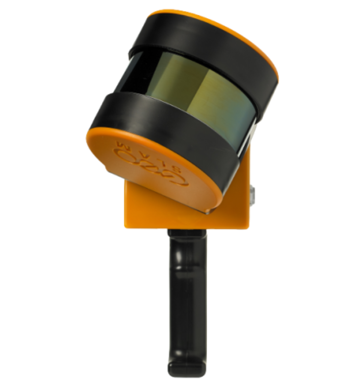
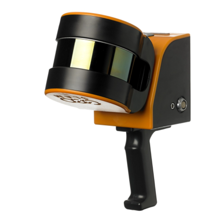
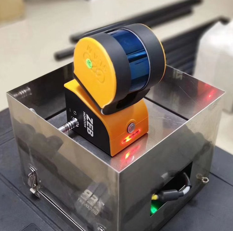
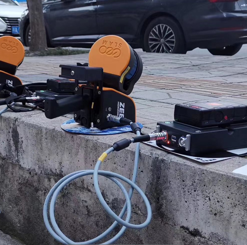
#GeoSLAM ZEB-Horizon 3D Mobile Scanner - Lightweight and rugged, ZEB-HORIZON is simple to use, fast to capture and easy to process, so you have the most accurate information you need to make the most important decisions. With powerful SLAM technology at its heart, the ZEB-HORIZON can even be used in remote areas with poor GPS - such as underground or in forest environments.
Key Features & Benefits
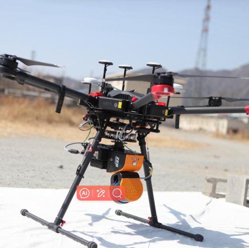
Portable and versatile with UAV and vehicle compatibility
Can be used in remote areas (underground mines, forests, etc.)
Range of 100m
Collects 300,000 points per second
Accuracy between 1-3cm
Add contextual video and imagery to your 3D scan data with optional ZEB Cam accessory
Unlock the Benefits of GeoSLAM Scanners
More competitive: Being able to offer rapid results to clients makes everything you do more competitive.
Ease of Use: GeoSLAM scanners can be used by anyone, so you don’t need to be a professional surveyor to create accurate 3D models.
Go anywhere: GeoSLAM can be used anywhere, from the tightest spaces to remote spots without the need for GPS.
Speed: If you can scan faster, you can work faster, maximizing your efficiency.
Continuous data collection: GeoSLAM scanners allow for continuous data processing which means you can see individual measurements including topographical details alongside key features.
Accuracy: From design, to construction and maintenance, our mobile scanners can be used to quickly and accurately scan and collect data at each stage of the building’s development.
Create and manage a digital twin: For true project collaboration, effortlessly and accurately create a digital twin of any built environment – both indoor and outdoor.
Applications & Specs
2D floor plans
3D volumetric calculations
scan-to-BIM
Object identification

Unlimited Solutions: With a collection rate of 300,000 points per second, and an accuracy* of 1-3cm, the ZEB-HORIZON is suitable for a vast array of applications, including:
2D floor plan generation
3D volumetric calculations
Measured Building Surveys
Scan-to-BIM
Object Identification
Endless Possibilities: The complete solution comes in a backpack for simple transportation and ease of use, but there are many more options to suit your survey:
Elevate the ZEB-HORIZON with an extendable pole to increase scanner range, or to access hard-to reach spaces (such as ceiling voids).
Attach the ZEB-HORIZON to the GeoSLAM Cradle to lower into inaccessible areas (such as manholes).
Mount the ZEB-HORIZON to a UAV and take to the skies for complete coverage of all features.
Add contextual imagery to your data with an optional ZEB-CAM.
Learn more about our Software: Transform your scan data into actionable intelligence with GeoSLAM Hub.
Industry-leading SLAM processing to generate accurate 3D point clouds from mobile data
Automatic registration of multiple scans and geo-referencing of datasets to control
Import, view and interrogate data captured from all GeoSLAM mobile mapping devices
Generate simple and fast 3D measurements and 2D CAD deliverables
Easily export data for use with all major third-party CAD and GIS software packages
Technical Spesification
Range: 100m (features <40m)
Protection class: IP54
Processing: Post
Data logger carrier: Backpack or shoulder strap
Scanner weight: 1.3kg
Colourised point cloud: Yes mproved
Intensity: Yes
Referenced imagery: Yes
Scanner points per second: 300,000
No. of sensors: 16
Automated scanner start: Yes
UAV compatibilty: High
360° camera compatible: Yes
Relative accuracy: 1 - 3cm
Raw data file size: 100-200MB* a minute
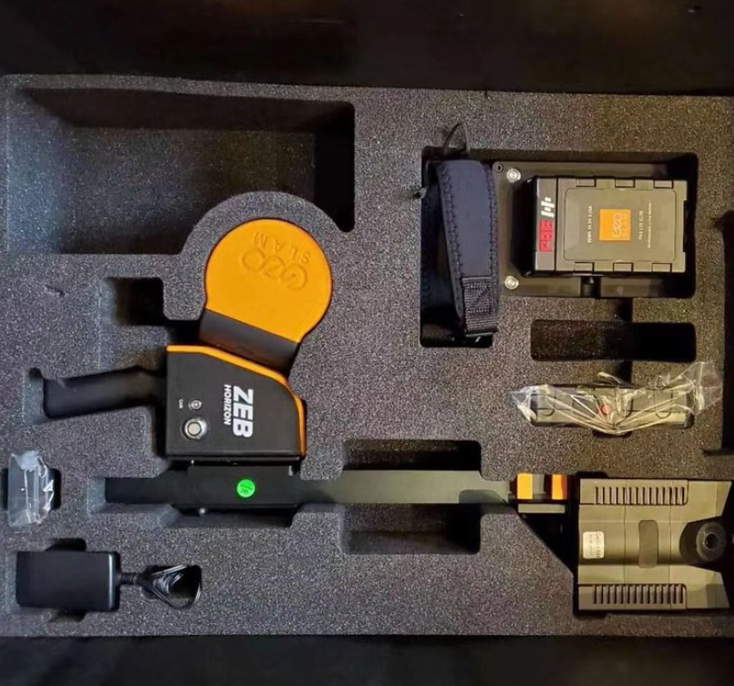
package includes;
- ZEB-HORIZON HDD data logger (CPU)
- ZEB-HORIZON Cables Set
- ZEB-HORIZON Battery pack
- GeoSLAM Hub & Draw Start license
- USB3 memory stick containing Installation & User Guide
- ZEB-HORIZON Backpack - Protection and easy transportation
- Additional ZEB-CAM-HORIZON
- 1 year hardware warranty
- 1 year GeoSLAM Hub & Draw Start software support
- ZEB CAM HORIZON - Hawkeye Firefly 8S