Search for more information
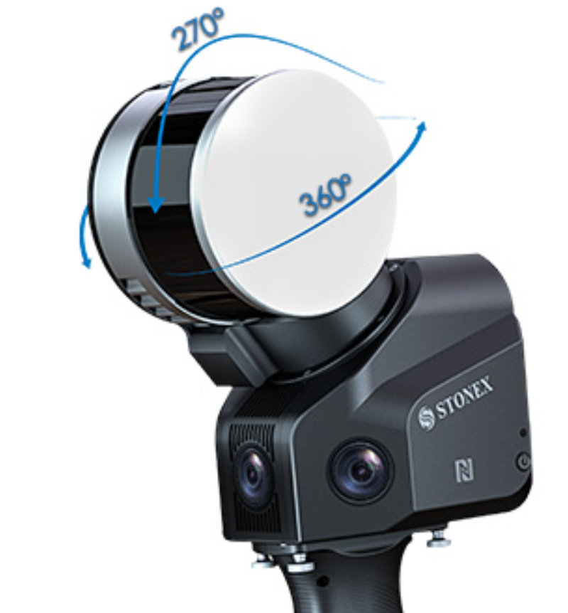
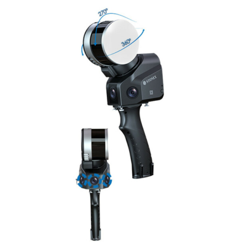
X120GO system has a 360° rotating head, which can generate a 360°x270° point cloud coverage. Combined with the industry-level SLAM algorithm, it can obtain high-precision three-dimensional point cloud data of the surrounding environment without light and GPS. Equipped with three 5MP cameras to generate a 200°FOV horizontal and 100°FOV vertical, capable of synchronously obtaining texture information and producing colour point clouds and partial panoramic images.
372 mm x 163 mm x 106 mm 1,6 kg (without battery)
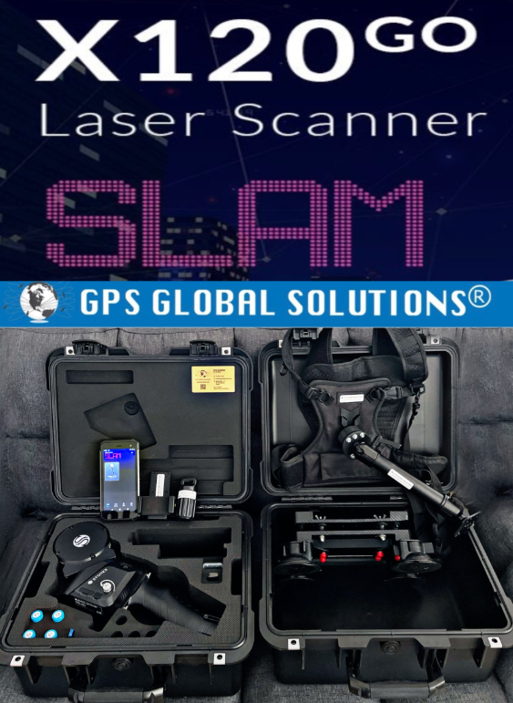
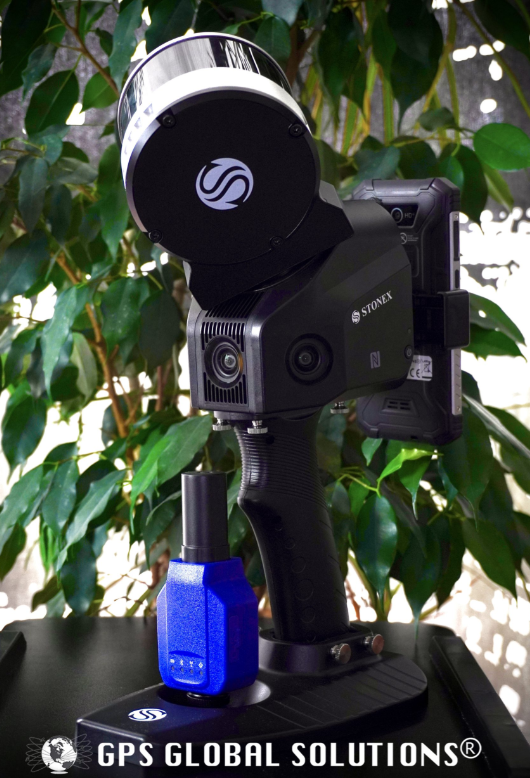

#Stonex X120GO Slam 3D Laser Scanner——X120GO has an integrated structure design with a built-in control and storage system and built-in replaceable lithium batteries. Once pressed the start button, X120GO can start operations immediately, making data acquisition more efficient and convenient.
Description
The system has a 360° rotating head, which can generate a 360°x270° point cloud coverage. Combined with the industry-level SLAM algorithm, it can obtain high-precision three-dimensional point cloud data of the surrounding environment without light and GPS. Equipped with three 5MP cameras to generate a 200°FOV horizontal and 100°FOV vertical, capable of synchronously obtaining texture information and producing colour point clouds and partial panoramic images. X120GO can use GOapp to check and manage projects which will be updated and displayed synchronously. Real-time SLAM mapping and preview can be achieved via GOapp. GOpost can perform post-processing of collected data, generate high-precision and high-definition color point clouds, produce partial panoramic images, display point cloud and perform optimization processing. X120GO has an integrated structure design with a built-in control and storage system and built-in replaceable lithium batteries. Once pressed the start button, X120GO can start operations immediately, making data acquisition more efficient and convenient. You can manage your point clouds in the office with Cube-3d and Stonex Reconstructor Software or, if you need something different, you can use PointCab. Thanks to the collaboration between Stonex and PointCab, you can process X120GO data with it.

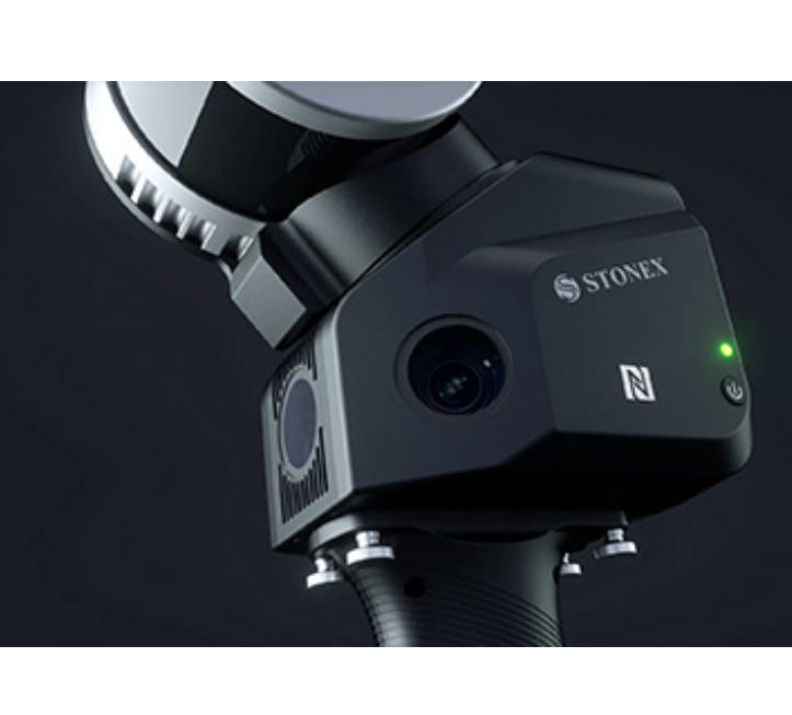
Stonex X120GO Slam 3D Laser Scanner
The X120Go is an handheld laser scanner based on the newest STONEX SLAM technology.This powerful scanner allows easy and fast capture of 3D models indoor & outdoor spaces, eliminating the need for complex multi-cloud registrations. Just move around the scene with X120 Go and see the point cloud growing as more data is added in real time.
The system has a 360° rotating head, which can generate a 360°x270° point cloud coverage. Combined with the industry-level SLAM algorithm, it can obtain high-precision three-dimensional point cloud data of the surrounding environment without light and GPS. Equipped with three 5MP cameras to generate a 200°FOV horizontal and 100°FOV vertical, capable of synchronously obtaining texture information and producing colour point clouds and partial panoramic images.
You can manage your point clouds in the office with our Cube 3D and Stonex Reconstructor (contact us for pricing) Software or, if you need something different, you can use PointCab (Included in the price). Thanks to the collaboration between Stonex and PointCab, you can process X120GO data with it.
RAPIDITY AND REDUCED WORKLOAD
No more multiple scan station, just move around the scene to collect the entire 3D point cloud, without time-consuming cloud to cloud alignment. Download the full data right after the capture.
FLEXIBILITY
Combine indoor & outdoor data, even in the most demanding environments.
REAL TIME PREVIEW
± 5 degrees tilt supplement angle for precise leveling. A 360° one-stop scan requires only 45s.
AUTOMATIC CONTROL POINT MEASUREMENT
When capturing data, X120GO is able to collect reference points too. They can be matched with known control points to georeference the scans.
INTEGRATED CAMERAS
Three integrated 5MP cameras are able to cover the wide field of view of the scanner, obtaining coloured point cloud and panoramic images.

FAQ
1、Is it mandatory to use GOapp?
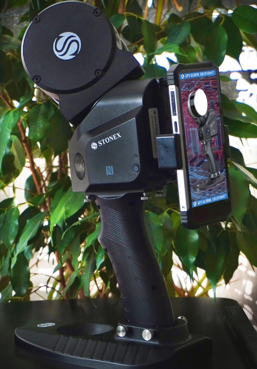
No, it is not mandatory. You can choose to collect data using the Android App, in case you need to see the real time preview point cloud. Otherwise, the power button of the device can work as scanning start and stop.
2、Can I use it in dark environments?
Yes, darkness affects neither the geometric data nor the intensity of the point cloud.
Only the color information will not be usable, having taken dark photographs.
3、Which distance can I cover with the scanner?
The range shown on the brochure represents the maximum distance achieved by the lidar.
However, you have to keep in mind that in order for the SLAM algorithm to be able to process the cloud optimization, you must have geometric elements within the 50-meter range. Therefore, it is not recommended to work in environments that are too open, with no buildings or objects around.
4、What is the benefit of using RTK module?
Certainly, the first benefit of using RTK is to have the 3D model georeferenced, without the need to collect GCPs. In open environments, it can also help the SLAM algorithm in improving the final restitution.
5、Do I need to close the scan path?
In general, it is not mandatory: the heterogeneity of the environment may be sufficient. On the contrary, if you are in a difficult situation for SLAM, closing the loop means adding a constraint that helps the system.
6、What advantages does the panoramic camera give?
Stonex SLAM scanners are all equipped with point cloud colouring cameras, but if you prefer to have spherical images that you can navigate through to see more detail or take measurements more easily, the panoramic camera is the solution.